Originally posted on Streets.MN.
On Monday, August 3rd, the Metropolitan Council and a coalition of groups supporting the METRO Blue Line Extension (also known as Bottineau LRT) made a major announcement. After years of fruitless negotiations with the BNSF railroad over an agreement to run light-rail trains in their right-of-way, the public partners announced that they were giving up on that alignment.
Although this setback means a waste of money and a further delay of a long-awaited mass transit expansion, it is great news for anyone who wants to see the Twin Cities build light rail that serves as many people as possible. The previously chosen alignment for the METRO Blue Line Extension would’ve sent trains around the extreme fringes of Minneapolis’ Northside. Two stations were proposed for a gulch, bordering a marsh to the west and the edges of mostly lower density neighborhoods to the east. Multiple stations were proposed for one side of a dangerous suburban highway, with few improvements to its character. No station was proposed for the vicinity of a major hospital despite the route passing nearby. Despite having cost $129 million over a 12 year planning process, the project was destined to be a lemon.
That is not to say that the concept of transit to the Northside and the Northwest suburbs is a bad one. The opposite is true. That's a major reason why the project’s setback is so welcome. Although BNSF was likely motivated more by petty grievance than altruism, the railroad’s stonewalling gives the Met Council and its partners a chance at a do-over that they did not want but now must embrace. Second chance opportunities are rare for major infrastructure projects like this one, which build a kind of momentum that can lock in bad decisions and result in extremely expensive failures when complete. Thanks to the collapse of the project’s preferred alignment in the late planning stages, but the strength of its overall political support, there is every opportunity to reboot the METRO Blue Line Extension better than ever before and still have confidence in its ultimate completion.
Yet in order to correct the errors that made this project so unfortunate, they must first be clearly identified and labeled. Without a clear understanding of where wrong turns were made, there can be no assurance that they won’t be made again. What the experience of the METRO Blue Line Extension—and unfortunately many other American transit projects—shows is how establishing the right priorities and keeping them in the right order is the key to delivering projects that become not just lines on a map, but the essential arteries of the cities they serve.
A Rich American Tradition of Error
The bad news is that the Blue Line Extension is not alone. The United States has spent the last several decades building a huge number of ineffective light rail projects. A 2020 report from Connor Harris, a researcher with the conservative Manhattan Institute found that American light rail transit (LRT) projects were systemically overly expensive, under-used, and unsupported by complimentary policies.
Specific cities make for galling examples. In the past ten years, the Dallas-Fort Worth Metroplex has spent and will spend a combined $4.03 billion dollars on three rail transit lines that are expected to carry a combined 9,905 weekday riders. The area’s DART system is so ill-planned and poorly thought-of, that when State Farm Insurance built a 10,000 employee campus directly next to an outlying transit station, ridership at that station actually declined.

DART's University of Dallas Station is on the left. The University is on the right, across the highway. See for yourself.
Another cautionary tale can be found in Denver, where billions of investment in light rail and commuter rail have failed to fundamentally transform that city’s transportation. The RTD system’s latest light rail expansion is a landmark among American transit failures, attracting so few riders that the agency cut back service within six months of its grand opening.
In contrast to its peers, the Twin Cities have built some of the country’s most cost-effective and popular new light rail. For roughly $2 billion in 2020 dollars, the region constructed almost 22 miles of track for two light rail lines that—prior to the novel coronavirus pandemic—notched an annual average of 77,000 weekday rides. The METRO system’s ratio of weekday ridership to track miles is second only to Seattle among new rail transit systems built in the twenty-first century.
But prior success does not guarantee future success. The under-construction METRO Green Line Extension, while a compelling project in many respects, will conspicuously avoid dense areas of activity in Minneapolis. This choice, which has been extremely well litigated, was in many ways the product of political pressures that are present in every city but do not have the same valence today. The METRO Blue Line Extension would’ve made errors of the same kind, but of an even greater magnitude. Seizing this change in direction is an opportunity for the Met Council and the Twin Cities to avoid the kind of boondoggle that has damaged the credibility and usefulness of transit in many other competing cities.
What separates the early successes of the first two LRT projects in the Twin Cities with their flawed extensions, and the fumbles in other cities? In his report, Harris persuasively argues that American cities have built too much LRT and built it in the wrong places. He identifies several specific mistakes that are made repeatedly, such as overvaluing airport connections or pinning hopes on the emergence of isolated “transit-oriented development” districts that inevitably disappoint. But Harris’ report does not offer satisfying resolutions to these problems. The existing auto-centric transportation systems of American cities are already extremely costly, in both up-front costs and in the long-term costs of pollution and carbon emissions. Building alternatives is a moral imperative. It should be possible for American cities to continue investing in transit, but do it more successfully. That requires identifying the pattern of practice that produces these mistakes.
It is not enough to simply notice individual things that have gone wrong and compile a checklist of what not to do. Transit planners are not idiots. There is no doctrine in the field that argues for the superiority of lines that travel around the remote borders of cities. Nor, I think, are there many politicians who are deliberately trying to build transit lines that fail. Yet these are often the outcomes anyway. This disconnect tells us that there are systematic factors at play, underlying currents that, over the long course of a major infrastructure project, frequently can sweep it down the wrong paths. The consistency of American transit project failures can be remedied by identifying and steering clear of these hazards in advance. I think that means, above all, ensuring that decision making is always being guided by the right priorities, and in the right order.
An Order of Operations: Corridor, Mode, Alignment
Big infrastructure projects are often guided by decisions made early in the process. These are usually expressed in early official documents like a Purpose and Need Statement, which lays out the broad justification for why the project is being pursued, and also influences subsequent decision making through inclusion and omission. This approach is fundamental to the discipline of planning. A process starts with the widest possible view, identifying broad issues, and eventually narrows that scope down over time as specific remedies are identified and implemented.
For major transit projects, planners must make a series of important decisions that follow this tried and true pattern of big to small. Three decisions stand out. First, planners must identify the project’s corridor. A transit corridor is a series of nodes that the project will serve with stations. The best transit corridors serve nodes with high densities of residential, employment, and leisure activity. For instance, the METRO Green Line LRT connects three major employment centers, residential hubs, and destinations; downtown Minneapolis, the University of Minnesota, and downtown St. Paul. Along the way, it also hits minor nodes like Snelling Avenue and the State Capitol, with stops in between serving existing, well-settled neighborhoods.
Corridors are usually determined, at least in the most general sense, before the start of a specific project. Regional transit investment plans might identify and prioritize corridors which have enough jobs, homes, and other attractions to justify upgrades to transit service. In the Twin Cities, for instance, the general locations of the first three LRT lines has been essentially agreed upon for generations. But at the start of work, it is not always established which specific nodes are essential parts of the corridor. For the METRO Green Line, it was clear to planners that a transit line was justified to connect both twin city downtowns. But it was also essential to include the University of Minnesota in that scope of the project, and ensure that it was well served. To this day, some people still argue that the METRO Green Line should’ve run down the center of I-94 in order to make a quicker trip between downtowns. These critics misunderstand the idea of a transit corridor. Today, the University is the line’s largest single trip generating node, in no small part because the METRO Green Line runs straight through it.
Only after choosing a corridor should planners progress to picking a project’s mode. A transit mode is the vehicle, associated infrastructure, and basic operational parameters that will serve the corridor. There are a lot of options, sometimes with minor differences between them. A project might study underground heavy rail, elevated heavy rail, light rail, bus rapid transit, local bus, or hybrid forms like light metro or arterial rapid transit. These terms can be confusing to the public and difficult to pin down even among professionals. But from a rider’s perspective, the differences between urban transit modes essentially boil down to whether the transit vehicle is a train or a bus, whether any private vehicles share its right-of-way, and how much capacity it has.
The factors that go into picking a certain mode should derive entirely from the characteristics of the chosen corridor. Chief among them is what the corridor’s actual travel demands are. With major employment nodes at both ends and a huge trip generator in the middle, a high capacity train with dedicated right-of-way made tremendous sense for the Twin Cities' central corridor, which became the METRO Green Line. With minor nodes and important connections along its route, a rapid bus in mixed traffic made sense for Snelling Avenue, which became the A Line aBRT.
Subordinate to both the choices of corridor and mode is the choice of alignment. A transit alignment is the actual path in physical space that the chosen mode will take, from whether it will turn or go straight, whether it will go up or go down, or whether it will go over here or over there.
Determining a project’s alignment is often the province of engineers, especially for rail projects. But it is also the province of planners, who must insist that alignment decisions are steered by choices already made about a project’s corridor and its mode. This is often crucial because, as a general rule, the densest and most congested corridors call for the most intensive transit mode. That can mean that the alignment that best serves a given node can have the greatest impacts during construction and mean the most significant changes after it. In the case of the METRO Green Line, planners persisted with a tricky and controversial alignment along Washington Avenue directly through the University of Minnesota, because that alignment best served the chosen corridor with the chosen mode. Their effort was rewarded with an extremely successful project.
These three simplified choices: corridor, mode, and alignment, are the heart of the transit planning process. While some important decisions come before (e.g. about the larger transit network) and others come after (e.g. about station-area development), these typically fall out of the purview of the planners of any discrete transit project. They may bear on the project or they may be born upon it, but they are not its core.
The choice of corridor determines where the future transit service will be provided. The choice of mode determines what type of service it will be. The choice of alignment determines how that service will get from point to point along its journey.
Getting the project right means not just getting these individual choices right, but getting them right in the correct sequence. A number of external factors may arise over the course of a project that provide difficulties and may tempt or necessitate a course change. Cost considerations. Political considerations. Timing considerations. These factors are real and they cannot be ignored. But they must be worked through with the right priorities in the right order. It is when these external factors bear too heavily on a project—especially when they force these crucial choices to influence each other in the wrong order—that the most common and systemic errors in American transit planning are made.
Mode Over Corridor: The Path-Of-Least-Resistance Error
One hallmark of American transit planning in the past two decades has been the use of easily available right-of-way. This sometimes means highways, and other times it means abandoned or little-used freight railroads. Many American cities, particularly in the west, are criss-crossed by highways and freight railroads, and these spaces appeal to politicians and planners because they offer the ability to build heavy rail, light rail, or BRT, while minimizing takings and construction disruption to the public.
At the same time, right-of-way that is easily available is not usually located next to nodes that are dense with jobs, homes, or other activities. When the availability of right-of-way determines the nodes to be served by a transit investment, then that is a case of prioritizing mode before corridor. I’m referring to it as a Path of Least Resistance Error.
The METRO Blue Line Extension is a classic example of this type of error. Politicians and planners understood that the project’s corridor had to include North Minneapolis. Politicians and planners also understood that the corridor would be served by light rail, because the uses justified it, for network balancing reasons, and for political parity. However, there was not an easy and obvious way to achieve both of these two goals. When they came into conflict, the demands of the chosen mode were given precedence over the responsibilities of the chosen corridor. The project was routed to travel along the BNSF freight right-of-way, which was presumed to be easier to secure. As a consequence, the new corridor virtually ignored North Minneapolis and completely avoided a minor job node at North Memorial Hospital. The result was a sullen imitation of useful transit.
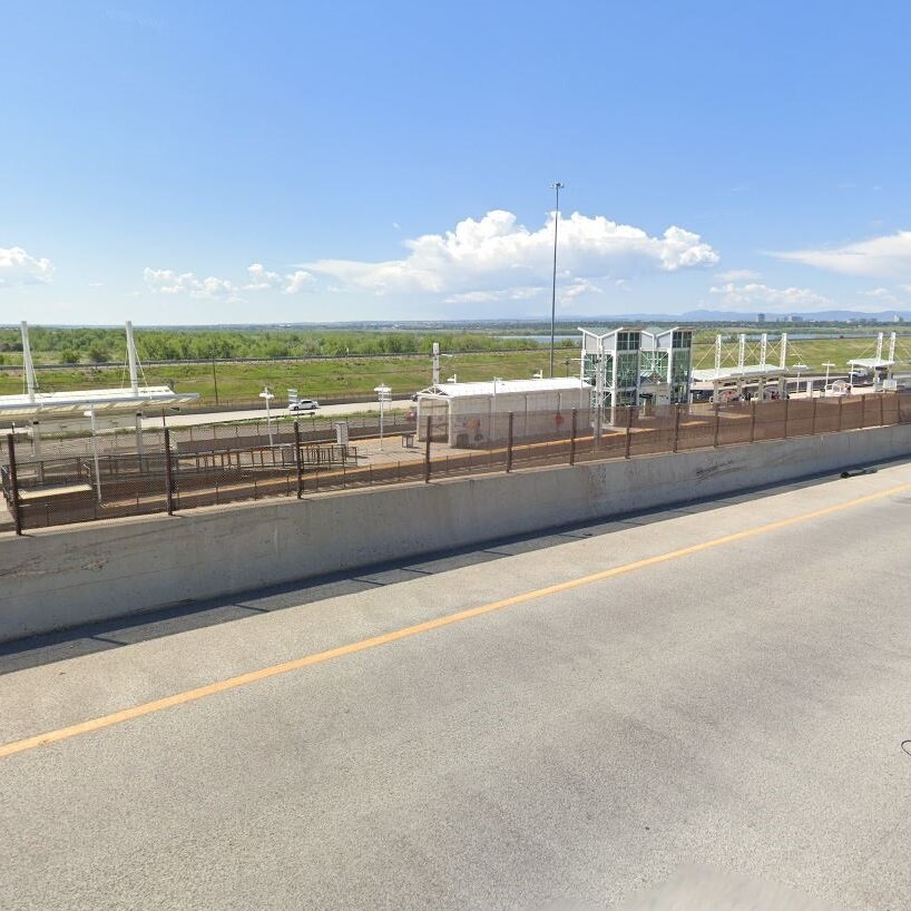
Google Streetview of RTD’s Iliff Station, with a highway on one side and acres of nothing on the other.
It is not hard to find similar case studies. Denver designed their entire system around using freight railroads and the sides of highways. As a result, they have been able to rapidly expand passenger rail service at a scale that has been otherwise unmatched in the country. But that approach has also resulted in a number of poor tradeoffs that cut major nodes out of the system in all but name. RTD light rail sideswipes the huge Anschultz Medical Center. It stops on the wrong side of I-25 from the busy Denver Tech Center. The station with the most service in the downtown area is located on its far fringe, leaving most commuters dependent on a free connecting shuttle to complete their journeys. In each of these cases, the ease of making the chosen mode work was prioritized over directly serving the major nodes that made up the corridor.
The Dallas-Fort Worth Metroplex provides another menu of cautionary examples. DART is the nation’s largest LRT system, with 93 miles of track and a couple of commuter lines to boot. As was the case with Denver, these impressive-seeming numbers were achieved by compromising every corridor in order to build in freight railroad or highway right-of-way. As is the case with Denver, the result has been ridership that does not come close to justifying the investment. Currently under construction is the DART Silver Line (formerly known as the Cotton Belt Line after the freight railroad whose former right-of-way it will use). It will run 26 miles and serve just ten stations, a good indication of the lack of demand along most of its route. Several of the actual station locations have to been seen to be believed. The Silver Line is projected to cost $1.2 billion and serve 5,630 weekday riders with DMUs running at 30-minute peak and 60-minute off peak headways. It is hard to imagine what obvious transportation need would justify such a line. It seems more likely that the line is being built simply because the right-of-way for passenger rail was available (DART purchased the land in 1990 and has evidently not reconsidered whether the route makes sense since), and that any cobbled-together corridor of nodes was justified after the fact.
It is not always a mistake to take a path of little resistance. Most projects rely to a large degree on planners and engineers finding ways to fit the chosen mode into the existing landscape in a way that will minimize impacts. But these choices must come secondary to the top priority of the project, which is serving the nodes that make up the corridor. The original METRO Blue Line runs on old freight right-of-way, and alongside a highway. It is still successful because for the most part, it does not shortchange the most critical nodes that make up its corridor. Its proposed extension, and so many other transit lines across the country, were not planned with similar priorities.
Alignment Over Mode: The Streetcar Error
Especially in the last two decades, as American cities reversed a half-century of population decline, interest in investing in transit surged. Many civic leaders—especially in mid-sized cities with nothing more than bus service—fixated on rail transit as both a symbol of their city’s resurgence and as infrastructure with a genuine benefit. But building good rail transit is a long, costly, and politically fraught process. That is especially true when an alignment for a project is established.
Confronted with actual or expected difficulties in choosing an alignment, many cities compromised their chosen mode, sacrificing speed, capacity, and reliability. When the constraints of a chosen alignment determine the actual transit mode of the project, then that is a case of prioritizing alignment before mode. I'll call it the Streetcar Error.
The proposed Riverview Modern Streetcar in St. Paul shows how this error occurs. Politicians and planners identified a corridor connecting Downtown St. Paul, MSP Airport, and the Mall of America, with fast-developing neighborhoods in between. They whittled down the project’s possible modes, until the remaining options leaned towards the kind of high capacity, high frequency, congestion-free service that is offered by the rest of the METRO system. They then identified an alignment down West 7th Street, directly through the heart of the action. But that alignment brought with it several difficulties, especially close to downtown St. Paul, where there was insufficient width to run trains in dedicated right-of-way with both car travel lanes and car parking lanes. These difficulties then rebounded back upon the project’s mode choice. Instead of accepting the challenge of fitting light rail into a challenging alignment, the project study preemptively surrendered. A modern streetcar was proposed for the corridor, which will deliver a quality of transit service that is inferior to what presently exists.

Politicians and planners beware.
There are plenty of examples of modern streetcar projects in the United States, almost all of which were built in the last decade and almost all of which have been complete failures (Dallas, incredibly but unsurprisingly, has two of them). The proximate cause of this awkward trend was the attitude of the Obama era’s Federal Transit Administration, which was willing to provide matching funding for modern streetcar projects despite their obvious lack of transit utility. But the systemic cause was a willingness of politicians and planners to put concerns about alignments above the functionality of their nine-digit public investments.
(I briefly note here that not all projects that put alignment over corridor are streetcars, although they are by far the most common end result. One bespoke boondoggle is playing out in New York City, where New York Governor Andrew Cuomo has decided to construct an aerial tram to connect the city’s subway system to LaGuardia Airport. The Governor’s own personal opinions about the correct alignment appear to be driving the project’s environmental process, which is transparently an effort to justify conclusions that have already been reached.)
The actual mechanics of this error have rarely been laid out as plainly as they were with the Riverview Corridor process, or the LaGuardia AirTrain. Many cities, for instance, started with studies that explicitly looked for opportunities to build streetcar lines and did not consider other modes. But although they may not appear to be so at first, these too are cases of alignment being prioritized over mode. City officials did not need to wait for a specific alignment before compromising on a project’s mode because from the start they had none of the political will necessary to even weigh the impacts of a more useful transit mode, no matter the chosen alignment.
In these cases, the underlying prioritization of alignment over mode is made more explicit after the project has opened. Every day of streetcar operation is another day on which local political leaders could decide to close its right-of-way to private vehicle traffic. They never do. This version of the error is not only expressed as a one-time event that occurs in the planning process; it is often ongoing.
The Inter-relatedness of Priorities
I’ve tried to be clear about definitions, decisions points, and the relationships between them in this article. But it is not always easy, because in reality, the planning process is far muddier and less iterative than the three-step ideal I have laid out here. It is unavoidable that these issues of corridor, mode, and alignment should occasionally bleed into each other or interact in different and unique ways.
To take one example, the Rush Line BRT project to St. Paul’s northern suburbs would serve a corridor that includes both St. John’s Hospital and the Maplewood Mall. These are both nodes worth considering, but the only way to serve the latter is with a time-consuming jog in the alignment. To the greatest extent possible, jogs should be minimized and transit routes should run in highly legible straight lines. How can this be reconciled with the idea that a project’s corridor must take precedent over the ease of it’s alignment?
One answer might be that the jog to the Maplewood Mall will mean slower service along the corridor overall, reducing its usefulness to those other nodes. The Riverview Corridor study provided an example of this justification, as project planners ultimately rejected a jog to serve the Ford Site, which would’ve taken an extra 11 minutes to complete, really blowing a hole the line’s travel time. Somewhere in between the rejected Ford Site jog and the accepted Maplewood Mall jog perhaps there is a bright line that splits acceptable and unacceptable. But I doubt it. Every situation will bring out a unique list of benefits and costs. What is most important is that the project’s decision makers keep in mind the right priories in the right order, and use that framework to work through knotty questions. Select a strong corridor. Serve it with the right mode. Choose for that corridor and that mode the most conducive alignment. Always be asking; what is really important here?
Another way the process can be muddied is when choices rebound upon each other, with challenges at the front end eventually reaching back and poisoning a project in every respect. Cincinnati’s experience is maybe the most tragic American streetcar story not written by Tennessee Williams. The city that once dreamed of building a subway has a fairly obvious transit corridor running north to south, connecting the University of Cincinnati (and its medical center) and the downtown, with the thriving Over-The-Rhine neighborhood in the middle. But local and state leaders were never serious about the kinds of transit modes that such a strong succession of nodes would justify. They started with a streetcar study, and negotiated against themselves from there. Today, the Cincinnati Bell Connector serves just a fraction of the city's seemingly ideal transit corridor. It trundles from the city’s riverfront stadiums, through downtown, and around Over-The-Rhine. In the fourth quarter of 2019, it served 800 weekday riders. It has been shut down due to COVID-19 since March 30th, but it serves so meager a purpose that nobody has seen fit to restart it since.
Ultimately the purpose of a transit project is to produce a good transit service. That seems obvious enough, but deep in the weeds, it is easy for teams of smart and honest people to lose their way. By the time a project emerges back into the sunlight, and it turns out that the bulk of their route misses a huge transit-dependent part of the city, the decisions that got it to that point are already baked in.
In the case of the METRO Blue Line, the Met Council and its partners have a do-over. The political context is different. The environmental context is different. But the structural challenges of planning a complex transit project still remain. As the agency and the project team pick up the pieces, it will be critically important that they do not again go off track.